Universal Coordinated Time UTC – ZULU is a 24 hour clock. During an eruption, if the wind is from the east at 10,000 feet (outflow), the tephra will fall on Vancouver, Canada in about an hour. If the Kulshan Wind is from the west (inflow) the tephra will fall on Merritt, BC in about 40 minutes. There are extremes in preparedness, of course. As a basis of my work I use the 2015 Profile of Earthquake Risk in the District of North Vancouver by Earthquake Canada, wherein they state that there is 30% chance of a M7.3 in the middle of the Salish Sea, say between North Vancouver, Nanaimo and Victoria, in the next 50 years, that will bring down 839 buildings, just among the 80,000 residents in the District of North Vancouver. Hyperlinked where I can. Good morning, everyone. We begin to deal with BIG (MEGA) EARTHQUAKES at New Cascadia Dawn © ™ ® - Cascadia Rising - M9 to M10+, An Intelligent Grandfather's Guides © ™ ® next, Mount Baker Stratovolcano (background) © ™ ® / Kulshan Stratovolcano © ™ ®, Simon Fraser University (foreground) ~ Image by Stan G. Webb - In Retirement © ™ ®, An Intelligent Grandfather's Guides © ™ ® next, The Man From Minto © ™ ® - A Prospector Who Knows His Rocks And Stuff © ™ ® Learn more about the Cascadia Volcanic Arc © ™ ® (Part of Pacific Ring of Fire) Cascadia Volcanoes © ™ ® and the currently active Mount Meager Massif © ™ ®, part of the Cascadia Volcanic Arc © ™ ® [ash flow, debris flows, fumaroles and hot springs], just northwest of Pemberton and Whistler, Canada ~ My personal interest in the Mount Meager Massif © ™ ® is that the last volcanic vent blew north, into the Bridge River Valley [The Bridge River Valley Community Association (BRVCA), [formerly Bridge River Valley Economic Development Society], near my hometown. I am the Man From Minto © ™ ® - A Prospector Who Knows His Rocks and Stuff © ™ ® (Severe). Earthquake Drill 3rd Thursday in October 19, 2023 at 10:20 AM Pacific I grew up in small towns and in the North where the rule is share and share alike. So, I'm a Creative Commons type of guy. Copy and paste ANY OF MY MATERIAL anywhere you want. Hyperlinks to your own Social Media are at the bottom of each post. Creative Commons License
This work is licensed under my Creative Commons Attribution 4.0 International License. SOUND ON >> TO WATCH FULL SCREEN start the video and click on the YouTube Icon at the bottom and expand there. Later When you close that window you will be brought back here.

Thursday, July 25, 2019

Kulshan Stratovolcano© / Mount Baker Stratovolcano©, An Intelligent Grandfather's Guide©

Kulshan Stratovolcano© / Mount Baker Stratovolcano©, An Intelligent Grandfather's Guide©

Kulshan Stratovolcano© / Mount Baker Stratovolcano©

[https://mountbakerstratovolcano.blogspot.com/]
Published on Jun 12, 2019
Active Stratovolcano east of Bellingham, Washington State and Vancouver and Victoria, Canada

Unfortunately the Movies were only recorded on Quicktime, a proprietary Apple product. None of the rest of the world can view them.
Internet video or online video is the general field that deals with the transmission of video over the Internet. Internet video exists in several formats, the most notable being AVCHD, FLV, and MP4.
There are several online video hosting services, including YouTube, as well as Vimeo, Twitch, and Youku. In recent years, the platform of internet video has been used to stream live events.
Home
There is a lot more information about Mount Baker at the MBVRC blog. Please go to http://mbvrc.wordpress.com/ to learn much more about this active volcano.

Tuesday, July 9, 2019

It's about 250-300kms from downtown Vancouver in Washington state, based on google maps.
Super Telephoto or Layered ?
(Layers are used in digital image editing to separate different elements of an image. A layer can be compared to a transparency on which imaging effects or images are applied and placed over or under an image. Today they are an integral feature of image editors.on edit. ~ Wikipedia]

Dorr fumaroles 2375 m (7800 ft) elevation at the base of the Cockscomb, the rocky, rugged northeast ridge of Mount Baker dividing the Park and Rainbow Glaciers


Published on Sep 29, 2017
SUBSCRIBE 2M
On May 18, 1980, the Mount St. Helens became the largest and most destructive volcanic eruption in U.S. history. By the end of its cycle of fire and fury, 57 people had died.


(Si
Image result for Mapping fumaroles at Baker’s Dorr Fumarole Field
Dorr fumaroles 2375 m (7800 ft) elevation at the base of the Cockscomb, the rocky, rugged northeast ridge of Mount Baker dividing the Park and Rainbow Glaciers (also see the map on the ‘About MBVRC’ page).  Mount Baker's summit
North E
ast

  If sulphuric acid-rich water accumulates as a pool below the sulphur rich Door Funmole Field (Image above) and it persist as a layer long enough to reach Whalelech Dam, it will attack the concrete. However, even if the acid load from the water basin feeding into Whalelech does not greatly increase, occasional light fish mortalities may result near the mouth of the creeks. Greater acid and mineral loads, resulting from further increases in volcanic activity or other possible causes, could be more harmful, especially to the fish. Continued monitoring of  Whalelech watershed and collection of low and water quality is needed to detect rapidly any changes in conditions at Dorr Crater and to provide warning of possible greater impacts on Whalelech Lake from any future increases in Mount Baker activity.  Of course, if there is a lahar that hits the Whalelech system, it will cause a tsunami that will overtop the dams and spillways, smash everything apart all the way down in about two minutes.  The same as the tsunami on Spirit Lake at Mount St. Helen's.  

From the Series: Make It Out Alive: Mount St. Helens http://bit.ly/MtStHelensAlive

Tuesday, July 2, 2019

Simon Fraser University (Foreground) Kulshan Baker Stratovolcano (Backg...

Hyperlinked to my material at:
Kulshan Stratovolcano© / Mount Baker Stratovolcano©, An Intelligent Grandfather's Guide©


Is Mount Baker a hazard for Canada? - Perspective From Natural Resources Canada

How might ash from a Mount Baker eruption affect Canada? ... Explosive eruptions of Mount Baker that generate volcanic ash have been less frequent than at other Cascade volcanoes, but they still pose a potential hazard. A large explosive eruption is unlikely.

BAKER LAKE AT UPPER BAKER DAM NEAR CONCRETE, WA WaterAlert service
The U.S. Geological Survey WaterAlert service sends e-mail or text (SMS) messages when certain parameters, as measured by a USGS real-time data-collection station, exceed user-definable thresholds. The development and maintenance of the WaterAlert system is supported by the USGS and its partners, including numerous federal, state, and local agencies.
Real-time data from USGS gages are transmitted via satellite or other telemetry to USGS offices at various intervals; in most cases, 1 to 4 times per hour. Emergency transmissions, such as during floods, may be more frequent. Notifications will be based on the data received at these site-dependent intervals.
https://youtu.be/RimhzRgPtB0   [2:47 minutes]

Errata: References via Wikipedia: Seattle City Light (erroneously referenced in voice-over in the video as Seattle Light and Power). should be Puget Sound Energy (PSE), with headquarters in Bellevue, Washington.  It is the operator Baker River Hydroelectric Project on the Baker River, generating 170 MW of electricity.   It is a Washington state energy utility providing electrical power and natural gas primarily in the Puget Sound region of the northwest United States. The utility serves electricity to more than 1.1 million customers in IslandKingKitsapKittitasPierceSkagitThurston, and Whatcom counties; and provides natural gas to 750,000 customers in King, Kittitas, Lewis, Pierce, Snohomish and Thurston counties. The company has a 6,000-square-mile (16,000 km2) electric and natural gas service area.  It is a private company head quarts in Bellevue (/ˈbɛlvj/ BEL-vyoo) is a city in the Eastside region of King County, Washington, United States, across Lake Washington from Seattle. As the third-largest city in the Seattle metropolitan area, Bellevue has variously been characterized as an edge city, a suburb, boomburb, or satellite city.[6][7] Its population was 122,363 at the 2010 census[8] and 147,599 in a 2018 census estimate.
As of 2019, the city promotes itself as a diverse, global city at the heart of Seattle's Eastside, and home to some of the world's most innovative technology companies. Prior to 2008, downtown Bellevue underwent rapid change, with many high-rise projects under construction, and was relatively unaffected by the economic downturn. The downtown area is currently the second largest city center in Washington state, with 1,300 businesses, 45,000 employees and 10,200 residents.[9] Based on per capita income, Bellevue is the 6th wealthiest of 522 communities in the state of Washington.[10] In 2008, Bellevue was named number 1 in CNNMoney's list of the best places to live and launch a business,[11] and in 2010 was again ranked as the 4th best place to live in America.[12] In 2014, Bellevue was ranked as the 2nd best place to live by USA Today.[13] More than 145 companies have been located in Bellevue. Current companies with headquarters in Bellevue include ExpediaPACCAR IncT-Mobile and Valve Corporation.
The name "Bellevue" is derived from the French words for "beautiful view".[14]
The main campus for the Microsoft headquarters is located in Redmond, Washington. The headquarters is home to thousands of workers. Of the 59,000 employees in the United States, more than 42,000 call Washington state home.


Wednesday, June 26, 2019

For my dad, My first hero - Kulshan Stratovolcano© / Mount Baker Stratovolcano©

Kulshan Stratovolcano©, My Muse
Dad forgot to teach me that there was anything that I could not do; I was capable, strong and raised to lead. In other words I could do anything. I was raised without fear; and that is very different from being brave.

Kulshan Stratovolcano©, My Muse


https://youtu.be/vJlzQIAVH30 [2:57 minutes]

Hyperlinked to my material at:
Kulshan Stratovolcano© / Mount Baker Stratovolcano©, An Intelligent Grandfather's Guide©
Originally published on Jun 12, 2019
Active Stratovolcano east of Bellingham, Washington State and Vancouver and Victoria, Canada https://mountbakerstratovolcano.blogs...

Monday, May 20, 2019

Dorr fumaroles Mount Baker's summit

Image result for Mapping fumaroles at Baker’s Dorr Fumarole Field
Dorr fumaroles 2375 m (7800 ft) elevation at the base of the Cockscomb, the rocky, rugged northeast ridge of Mount Baker dividing the Park and Rainbow Glaciers (also see the map on the ‘About MBVRC’ page).  Mount Baker's summit
North E
ast
Mapping fumaroles at Baker's Dorr Fumarole Field. Figure 1. ... A fumarole field is an area with volcanic steam vents. Other than the numerous steam vents in Sherman Crater south of Mount Baker's summit, the Dorr fumaroles are the only known center of fumarolic activity on Mount Baker.

Baker’s Dorr Fumarole Field Overlooking Wahlachean Lake

The following report and photos were provided to MBVRC by Dr. Jeff Witter, Vancouver, B.C. Jeff studies gas emissions at active volcanoes. He heads up the International Volcano Monitoring Fund, a non-profit organization that seeks to assist third world volcano monitoring programs.
Visit the website: http://ivm-fund.org
Related image
Figure 1. The Dorr Fumarole Field is located high on the NE flank of Mount Baker and is much smaller than the main area of steam vent activity at Sherman Crater.

Mapping fumaroles at Baker’s Dorr Fumarole Field

On July 25 – 27, 2009, Jeff Witter and Ryan Wilson crossed steep ice slopes and glaciers to map the little-known Dorr fumarole field. These fumaroles are at ca 7800 ft (2375 m) elevation at the base of the Cockscomb, the rocky, rugged northeast ridge of Mount Baker dividing the Park and Rainbow Glaciers (also see the map on the ‘About MBVRC’ page).
Their goal was to make a map of the extent and geologic characteristics of the fumarole field as well as to assess current fumarolic activity for comparison with previous reports. A fumarole field is an area with volcanic steam vents. Other than the numerous steam vents inSherman Crater south of Mount Baker’s summit, the Dorr fumaroles are the only known center of fumarolic activity on Mount Baker. Access to the Dorr fumarole field is not easy and requires a rope, an ice ax, and glacier travel experience. An overnight camp on Ptarmigan Ridge is required if any time is spent working at the fumaroles.At Dorr, the steam vent activity has converted the nearby rocks into clay and other minerals in a process called hydrothermal alteration, the result of sulphur-rich gas emitted by the fumaroles.
Jeff and Ryan’s mapping revealed that the Dorr fumarole field is a ~400 m long x ~100 m wide N-S trending zone consisting of various types of hydrothermally altered ground; this is relatively small compared to other fumarole fields. The central and southern portions of the fumarole field are punctuated by numerous steam vents with the most vigorous steaming activity concentrated in the south.

During the July 2009 visit, no less than 12 individual steam vents were mapped. Several more steam vents were observed but not mapped in the southernmost sector of the fumarole field and on a rubbly slope beneath an ice cliff considered too hazardous to approach. The maximum temperature measured in the Dorr steam vents was 90 ºC, which is equivalent to the boiling point of water at that elevation, and comparable to most vents in Sherman Crater.

Steam emissions at the mapped vents were generally weak and wispy, easily dissipated by a light breeze. Observations at the Dorr fumarole field in July 2009 are in marked contrast to previous observations. In August 1990, Dave Tucker reported “hundreds” of thumb-sized steam vents scattered about the fumarole field. These qualitative observations suggest that activity at the Dorr fumaroles has decreased since 1990, consistent with studies concluding that the overall activity at Mount Baker volcano has been decreasing since the “failed eruption” of 1975 (e.g. Werner and others, 2009. See MBVRC References webpage.)
The team from the IVM-Fund plan to return to the Dorr fumaroles next summer to make quantitative measurements of the steam emissions to serve as baseline values for comparison with future measurements. A USGS-sponsored team also plans to visit the fumaroles in summer 2010 to collect gas samples for the first-ever chemical analyses of Dorr fumaroles gases.”

Thursday, May 16, 2019

What would happen if Mount Baker erupted?

Of course, nothing is mentioned here about the impact north of the Canadian border, 18 kilometres to the north; nor risk, in particular, on the Wahleach Hydro Project.
https://youtu.be/o_-xbEJcjG8   [1:30 minutes]
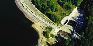
wahleach-dam-facility-300x150-place.jpg

Wahleach Falls Generating Station

Built: 1952
Generating capacity: 65 MW

Bellingham Herald
Published on May 8, 2018
With renewed interest following the eruption of Hawaii's Kilauea volcano, geologists say the biggest threat from Pacific Northwest volcanoes like Mount Baker is not lava, but mud and debris flows.

[This Webb Editor continues comments:  better comparisons should be made along the Cascadia Volcanic Arc; in particular Mt. Meager Mastif  has seen ongoing activity.]